IMAGE
Insurance Plan of City of Montreal, Plate 5. Item Info
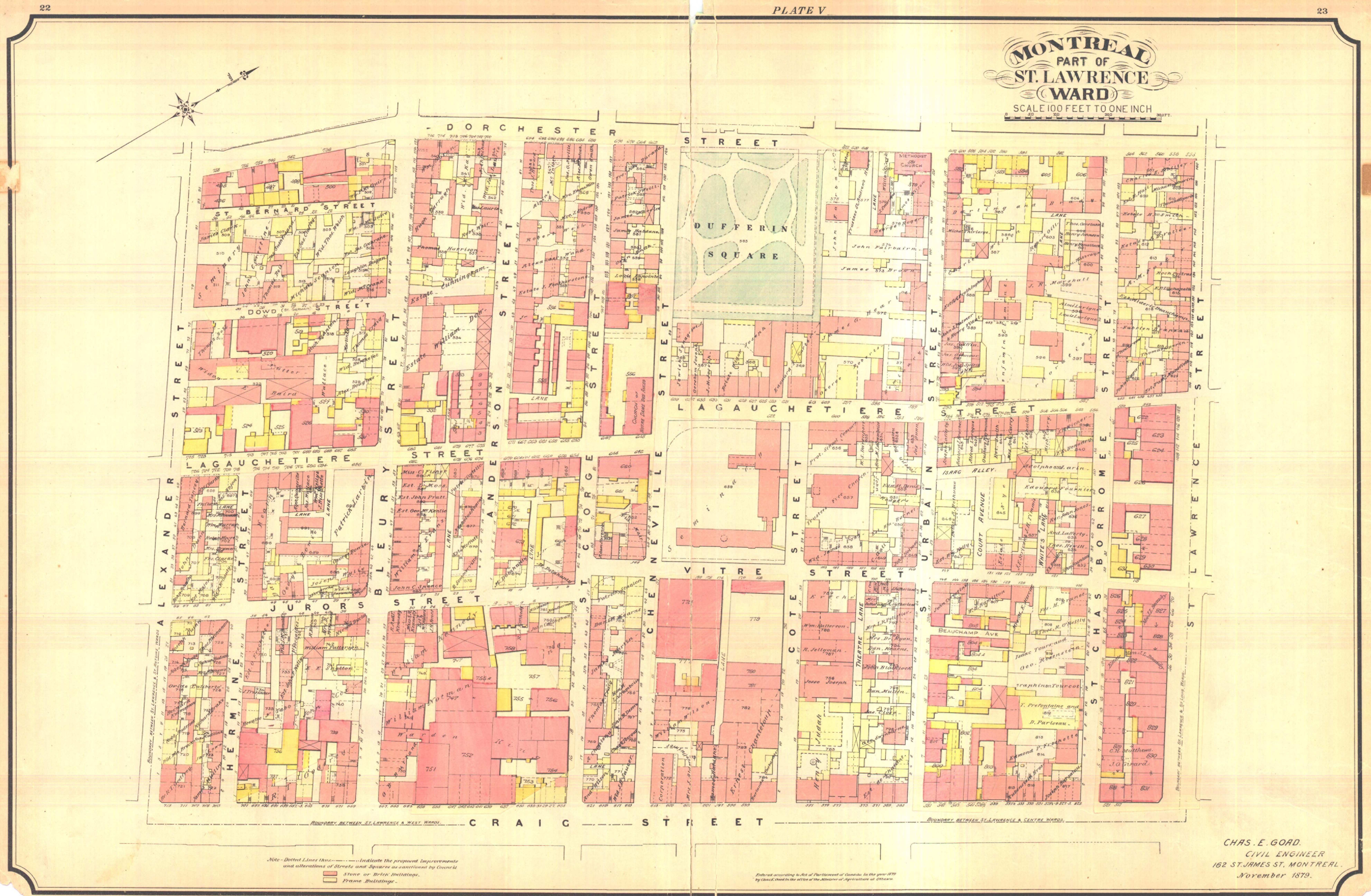
- Title:
- Insurance Plan of City of Montreal, Plate 5.
- Date Created:
- 1890
- Description:
- An insurance plan map showing Rue De La Gauchetière, the heart of many early Chinatown businesses and residences.
- Subjects:
- Chinatown
- Location:
- Montreal
- Latitude:
- 45.5026511
- Longitude:
- -73.563864
- Source:
- Bibliothèque et Archives nationales du Québec
- Type:
- Image;StillImage
- Format:
- image/jpg
Source
- Preferred Citation:
- "Insurance Plan of City of Montreal, Plate 5.", Early Chinese in Montreal,
- Reference Link:
- https://chinese-canadians.github.io/chinesemontreal/items/chinatown_04.html